VVMapping.com - providing high quality mapping products for outdoor recreation & Beyond
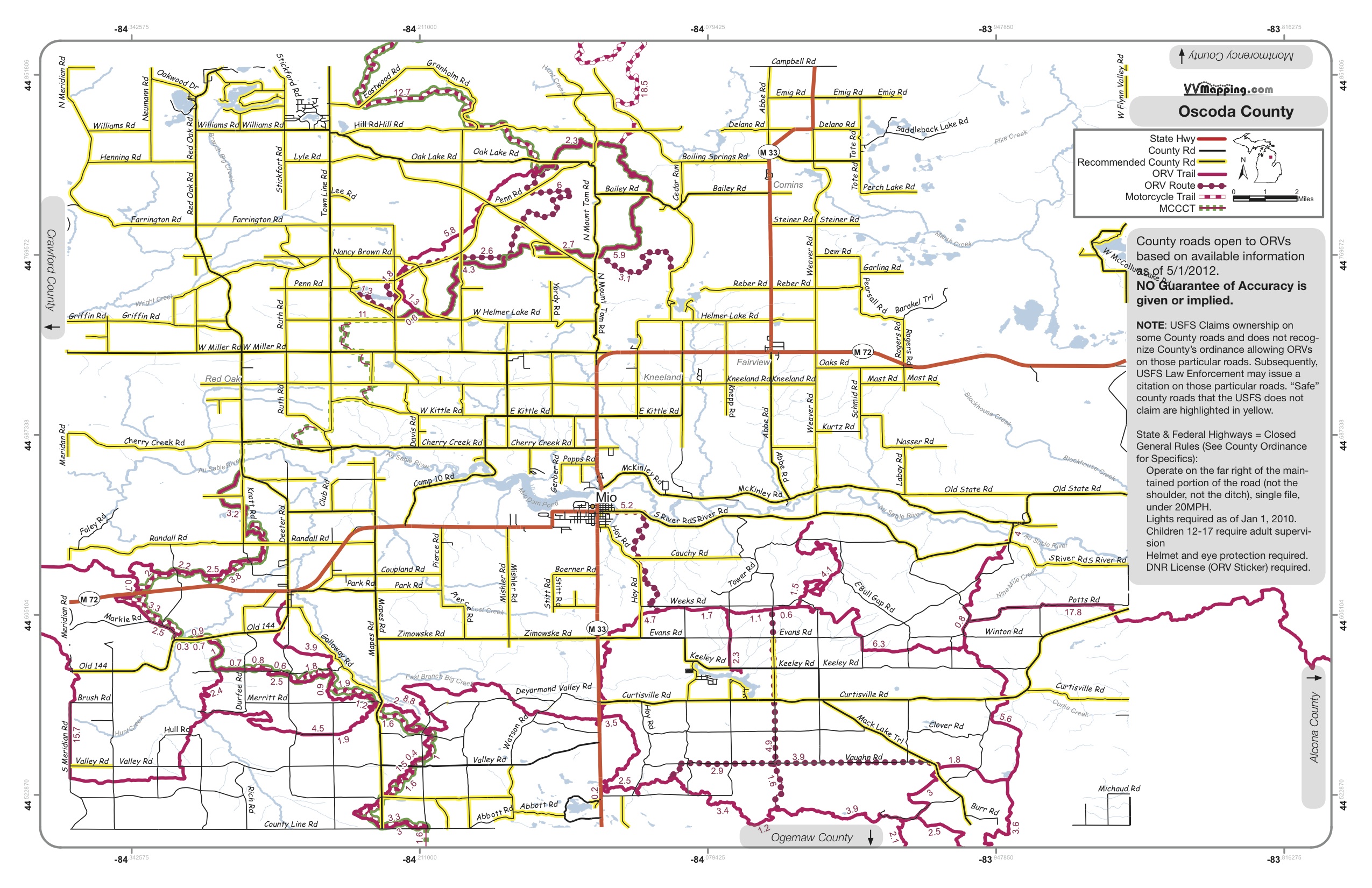
You are here -> Home: Info: MI Counties open to ORVs

Home

Free Maps

Store

ORV Trail Maps

Snowmobile Trail Maps

Outdoor Recreation Maps

Service/Support

Contact

Privacy Policy

About Us

Mailing List


Oscoda County

Main County Listing

Public Act 240 of 2008 enabled counties in Michigan to allow ORVs to travel upon roads under the counties' jurisdiction. Each county has to enact an ordinance allowing for this, else their roads remain closed to ORVs.

Roads
Date
County Web Site
Ordinance
Current As Of
Special Notes
All
4/14/09
5/22/2012

20MPH

USFS claims some County Roads as USFS Roads,County ordinance is not recognized by USFS on these "dual ownership" roads and USFS Law Enforcement may issue citation. Roads solely "owned" by the County are highlighted in yellow.

Trails: Bull Gap, Hunt Creek, Meadows, Mio, MCCCT
Map: VVMap_Oscoda.pdf

Information regarding ORV use in Michigan

Trail Guide at a glance

Big Picture of trail locations

Detailed Map Legend

Map Book Information

GPS Map Information

Email Webmaster@vvmapping.com for site issues/suggestions
Email info@vvmapping.com for all other items

Copyright 2008 Valley Ventures Mapping LLC