|
Home
Free Maps
Store
ORV Trail Maps
Snowmobile Trail Maps
Outdoor Recreation Maps
Service/Support
Contact
Privacy Policy
About Us
Mailing List
|
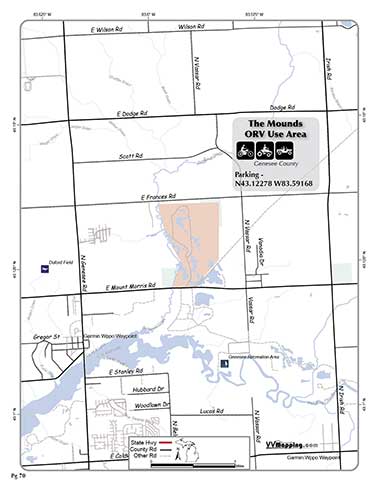
| Information on Mounds ORV Use Area
Back to Main Trail Info Page   
Mounds
Pg# 70 (PDF)
Width: 72"
Length: NA
Traffic: Lots
County Rds Open to ORVs: No
Forest Rds Open to ORVs: No
ORV Use Area. Varied terrain, based on old gravel pit. Cross country
travel permitted. Lots of wet areas. Seasonal closures. Daily fee
for entrance.

|
|
Information about this page Information regarding ORV use in Michigan
Trail Guide at a glance
Big Picture of trail locations
Map Book Information
GPS Map Information 
This work is licensed under a Creative Commons Attribution-Noncommercial-No Derivative Works 3.0 License
|


