VVMapping.com - providing high quality mapping products for outdoor recreation
|
|
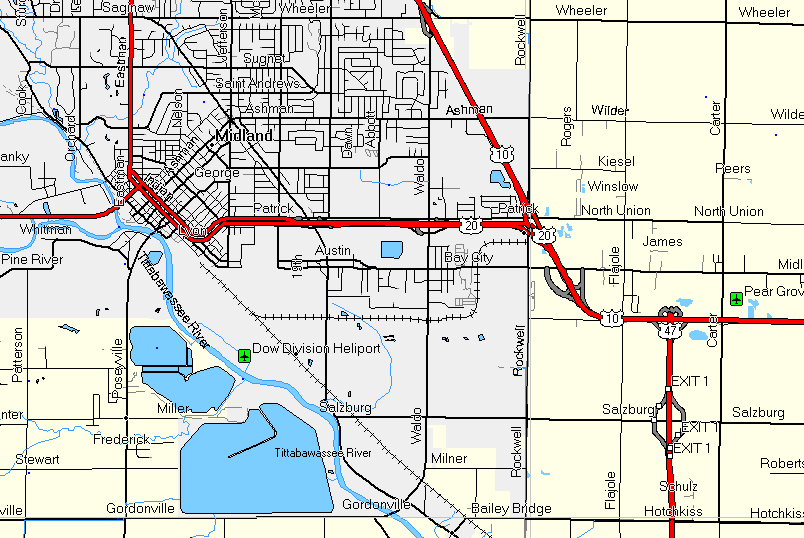
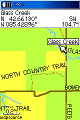
Free Maps for your GPS Garmin compatible maps of Southern Michigan Download the installation program: Version 1.02 (1/11/09) PC/Windows Users: VVMapping-Southern_Michigan.exe Note it is an 24MB download! PC version will install into MapSource or can be installed using the included SendMap program. Mac version requires BobCat & MapManager from Garmin. Overview of map features and as seen on the GPS Screen. This map installer is designed to integrate into an existing copy
of Garmin's MapSource. Included is SendMap, a program that allows
you to load the maps to your GPS without having MapSource installed. This item is totally free. No ads, no registration, no nagging, no nothing. We hope you like it, use it and become interested in our other products. This version is still in development and more features and refinements are planned. This map covers the counties south of US-10.
It is built on the most recent 1:24,000 scale data and includes
highways, roads, water
features and various points of interest. It also has public
land data including State Parks, State Recreation Areas and other
State-owned
land sections. The North Country Trail is
also included. It is segmented by county, so you can load all of
the counties
or
just
a couple
to
suit your
needs. They range in size from a few hundred K to a couple megabytes.
All total there is 32MB of map data with this installer. You should have map display/detail set to highest or most for best results. Also make sure map detail is shown, not hidden (see help or documentation (PDF)). List of Counties and their respective sizes:
A help file is available as well as documentation (PDF) to assist with installing the maps.
Questions? Please email us with your questions/suggestions. |
Please send us feedback! What would make this more useful, what type of GPS do you use, etc. Help for downloading and installing the maps. Documentation(PDF) is also included. Mailing List - Be notified of updates |