VVMapping.com - providing high quality mapping products for outdoor recreation
|
|
Printed Maps Michigan ORV Guide Book Current Edition is available for $45 (price includes tax and shipping).
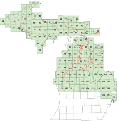
Our comprehensive Michigan ORV Guide covers all areas of the State which have ORV access available. All open county roads are shown as well as the complete ORV Trail System. If you only ride the 50" ATV and Motorcycle-only trails, the Trail Map Book may be a better choice. This book can help with trip planning, connecting trails and much more. Features:
These books are constanty updated througout the riding season. No big pre-productions here, each book is created on-demand. The Michigan Off-Road Vehicle Trail system is included in it's entirety. Both the upper and lower peninsula are covered. Over 3000 miles of trails! Even the connecting Michigan Cross Country Cycle Trails (MCCCT) trails. Current Motor Vehicle Use Map information included for all three National Forests. Each trail has been documented with a GPS unit, the most accurate product available. The book is 8.5" x11" and and the ~140 pages are wire bound for durability. Fits in most tank bags. It is not waterproof. Download this sample from the Guide Book (PDF) covering Newberry and Seney area. This book differs from our Trail Map Book of Michigan in that it is more of a plat book-style with continous coverage of all ears open to ORVs. The Trail Map Book has a trail on each page and does not cover areas without trails. Questions? Please email us with your questions/suggestions. |
Download this sample from the Guide Book (PDF) covering Newberry and Seney area. Please send us feedback! What would make this more useful, what type of GPS do you use, etc.
Mailing List - Be notified of updates |