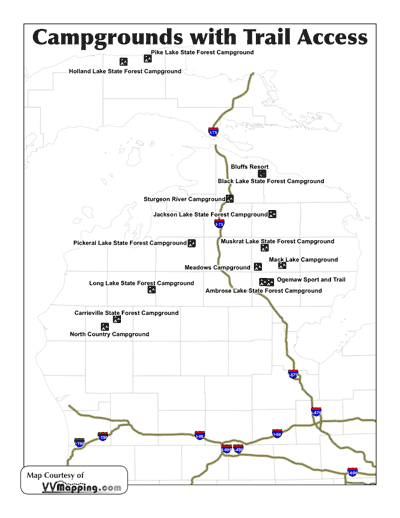
Locations of campgrounds with direct or semi-direct
access to ORV trails in Michigan. Includes links to trail detail,
included in our online MI ORV
Guide.
Some counties allow Off Road Vehicles to operate on county road
shoulders enabling enthusiasts to access ORV Trails from a campground
that may not otherwise directly connect to a trail. Campgrounds
in this situation are noted in the description.
Please note that the Michigan Department of Natural Resources
closed several campgrounds starting in 2007 due to budget issues; check with the DNR before hand for any State Forest Campground.
| Ambrose Lake State Forest Campground |
| Trail: Ambrose Lake |
| N44.40717 W84.25571 |
| Contact: |
| Phone: (989)275-4622 |
| Directions: |
| I-75 Exit 202 |
| M-33 North 20 Miles to Rose City |
| Rose City Road - West 6.2 Miles to Piper Lake Road |
| Piper Lake Road - South 1.1 Miles to Houghton Creek Road |
| Houghton Creek - Road West 1/4 Mile to campground |
| Description: |
| 19 sites, most will accommodate 40' vehicle/trailer. Located
on Ambrose Lake w/ boating & fishing access; off-road vehicle
trail head at campground. Rustic campground includes vault toilets
& potable water from well hand pump. Sites available on first-come,
first serve basis; no reservations. Check with State Forest
Campground Manager for seasonal availability. |
| |
| |
| Black Lake State Forest Campground |
| Trail: Black Lake |
| N45.49332 W84.26429 |
| Contact: |
| |
| Directions: |
| I-75 Exit 310 |
| M-68 - West 8.5 Miles to M-33 |
| M-33 - North 9.3 Miles to Mann Rd |
| Mann Rd - East 5 Miles to Black River Rd |
| Back River Rd - North 2 Miles to Twin Lakes Rd |
| Twin Lakes Rd - East 2.9 Miles to Doriva Beach Rd |
| Doriva Beach Rd - South/East 2.8 Miles to Eisens Trail |
| Eisens Trail - South 1/4 Mile to Campground |
| Description: |
| 50 sites for tent and small trailer use, 16 of these are lake
front camping sites. Enjoy a variety of recreational activities
and outdoor opportunities around scenic Black Lake. Rustic campground
includes vault toilets and potable water from well hand pump.
Sites available on a first-come, first-serve basis. No reservations.
Check with State Forest Campground Manager for seasonal availability.
Campground offers barrier-free facilities. |
| |
| |
| Bluffs Resort |
| Trail: Black Lake |
| N45.49559 W84.26926 |
| Contact: |
| 231-625-8443 |
| bluffsresort@voyager.net |
| www.bluffsresort.com |
| Directions: |
| I-75 Exit 310 |
| M-68 - West 8.5 Miles to M-33 |
| M-33 - North 9.3 Miles to Mann Rd |
| Mann Rd - East 5 Miles to Black River Rd |
| Back River Rd - North 2 Miles to Twin Lakes Rd |
| Twin Lakes Rd - East 2.9 Miles to Doriva Beach Rd |
| Doriva Beach Rd - South/East 2.6 Miles to Campground |
| Description: |
| On site restuarant/Bar in addition to gas. |
| Cabins and campground, electric hookups, showers. |
| Dump Station, but difficult to use due to location. |
| Tricky for big rigs over 30 to navigate, but they will fit |
| |
| |
| Carrieville State Forest Campground |
| Trail: Little Manistee |
| N44.03701 W85.72337 |
| Contact: |
| (231)775-9727 |
| Directions: |
| US-131 to Exit 162 |
| Old M-63/14 Mile - West 12.6 Miles (through Luther) to Kings
Highway |
| Kings Highway - South 1/2 Mile to Campground |
| Description: |
| 25 sites for tents and small trailers to use, 1 of which can
accommodate 40-ft vehicle/trailer. Located along the Little
Manistee River with good trout fishing, Off-Road Vehicle route
accessible from campsite. Rustic campground includes vault toilets
and potable water from well hand pump. Sites available on a
first-come, first-serve basis. No reservations. |
| |
| |
| Holland Lake State Forest Campground |
| Trail: Pine Ridge |
| N46.61587 W85.65594 |
| Contact: |
| (906) 293-3293 |
| Directions: |
I-75 to Exit 352 |
| M-123 - West/North 33 Miles (through Trout Lake) to M-28 |
| M-28 - West 23.7 Miles to M-123 |
| M-123 - North 8 Miles (through Newberry) to County Road 407 |
| County Road 407 - West/North 17.6 Miles to County Road 416 |
| County Road 416 - West 2.6 Miles to Campground |
| |
| Description: |
| 15 sites for tent and small trailer use. Rustic campground
includes vault toilets and potable water from well hand pump. |
| |
| |
| Irons RV Park and Campground |
| Trail: Little Manistee * |
| N44.13998 W85.89783 |
| Contact: |
| (231) 266-2070 |
| Directions: |
| US-131 to Exit 159 |
| US-10 West to M-37 (Baldwin) |
| M-37 North to 10 Mile Rd |
| 10 Mile Rd West to 10 1/2 Mile Rd (road curves twice and becomes 10.5 Mile) |
| Campground is on South Side (5 miles after leaving M-37) |
| Description: |
| *Requires travel on road to reach trail, county roads open
to ORV |
| 40+ large, RV friendly sites with full hookups available. |
| |
| Jackson Lake State Forest Campground |
| Trail: Atlanta |
| N45.08823 W84.16429 |
| Contact: |
| (989) 732-3541 |
| Directions: |
| I-75 Exit 282 |
| M-32 - East 33 Miles to M-33 (Atlanta) |
| M-33 - North 6.5 Miles to Campground |
| Description: |
| 18 sites for tents and small trailer use. There is 15 that
will accommodate 40 foot vehicle/trailers. Located on small,
peaceful Jackson Lake with boating and fishing opportunities.
Campground offers direct access to miles of scenic hiking pathway
as well as Off-Road Vehicle trail. Rustic campground includes
vault toilets and potable water from well hand pump. Sites available
on first-come, first-serve basis. No reservations. |
| |
| |
| Long Lake State Forest Campground |
| Trail: Long Lake |
| N44.33318 W85.37519 |
| Contact: |
| (231) 775-9727 |
| Directions: |
| US-131 Exit 183 |
| E 34 Rd - West 1 Mile to Old US 131 |
| Old US-131 - North 5.2 Miles to N 43 1/2 Rd |
| N 43 1/2 Rd - East/South 2.2 Miles to Campground |
| Description: |
| 16 sites for tent and small trailer use. Hilly hardwood area
on Long Lake offering boating and fishing opportunity. Motorcycle
trail access from campground (note trail is not maintained to
ATV widths). Rustic campground includes vault toilets and potable
water from well hand pump. |
| |
| |
| Mack Lake Campground |
| Trail: Bull Gap |
| N44.57883 W84.06412 |
| Contact: |
| Mio Ranger Station |
| 107 McKinley Drive |
| Mio MI 48647 |
| (989) 826-3252 Voice |
| (989) 826-3592 TTY |
| https://www.fs.fed.us/r9/hmnf/ |
| Directions: |
| I-75 Exit 202 |
| M-33 - North 30.2 Miles (through Rose City) to Curtisville
Rd/County Road 604 |
| Curtisville Road - East 4 Miles to Fowler Rd |
| Fowler Road - North 1 Mile to Keeley/County Road 489 |
| Keeley Rd - West 1/2 Mile to Campground |
| Description: |
| Huron-Manistee National Forest |
| Mack Lake Campground provides access to some of the best Off
Road Vehicle Trails in Michigan. The lake is surrounded by rolling
jack pine plains, which provide nesting habitat for the endangered
Kirtland's Warbler. The campground is scenic and secluded. Because
the lake is so shallow, fishing is marginal. |
| |
| |
| |
| Meadows Campground |
| Trail: Meadows |
| N44.56037 W84.30891 |
| Contact: |
| Mio Ranger Station |
| 107 McKinley Drive |
| Mio MI 48647 |
| (989) 826-3252 Voice |
| (989) 826-3592 TTY |
| https://www.fs.fed.us/r9/hmnf/ |
| Directions: |
| I-75 Exit 239 |
| M-18 - North/East 18 Miles (through Roscommon) to M-72 |
| M-72 - East 7 Miles to Deeter Rd/County Road 490 (Luzerne) |
| Deeter Rd - South 3/4 Mile to Old 144 |
| Old 144 - South/West 1.3 Miles to Durfee |
| Durfee - South 3.5 Miles to Campground |
| Description: |
| Huron-Manistee National Forest |
| The Luzerne Trail Camp is located along the Michigan Shore-to-Shore
hiking and horse riding trail. Maintained primarily by the Michigan
Trail Riders Association, the Luzerne Trail camp features beautiful
stands of oak and maple and offers a variety of wildlife for
hikers and horseback riders. In order to keep the trail camp
beautiful, visitors are asked to pack out what they pack in. |
| |
| |
| |
| Muskrat Lake State Forest Campground |
| Trail: Mio |
| N44.75264 W84.24085 |
| Contact: |
| (989) 348-6371 |
| Directions: |
| I-75 Exit 202 |
| M-33 North 41 Miles to N Mt Tom Rd (through Rose City & Mio) |
| Mt Tom Rd - North 1/2 Mile to W Miller Rd/County Road F-32/County
Road 608 |
| W Miller Rd - West 4.5 Miles to Richardson Rd |
| Richardson Rd - North 1 Mile to Muskrat Lake Rd |
| Muskrat Lake Rd - North/West 1.2 Miles to Campground |
| Description: |
| 12 shades sites for tent or small trailer use, 2 of which
will accommodate 40-ft vehicle/trailer. Located on Muskrat Lake,
a shallow, secluded, warm-water lake with good canoeing and
pan fishing. Quick access to Off-Road Vehicle trails. Rustic
campground includes vault toilets and potable water from well
hand pump. |
| |
| |
| North Country Campground |
| Trail: Little Manistee |
| N43.95896 W85.84391 |
| Contact: |
| (231) 745-4410 |
| Directions: |
| US-131 Exit 153 |
| US-10 - West 16 Miles to M-37 (Baldwin) |
| M-37 - North 4.1 Miles to 16th St |
| 16th St - East 1/4 Mile to Campground |
| Description: |
| Campground with on-site store |
| |
| |
| Ogemaw Sport and Trail |
| Trail: Ambrose Lake* |
| N44.40471 W84.18688 |
| Contact: |
| 989.685.2999 |
| ogemawtrails@aol.com |
| https://www.ogemawtrails.com/ |
| Directions: |
| I-75 Exit 202 |
| M-33 - North 18 Miles to Scribner Rd |
| Scribner Rd - West 3.5 Miles to Lentz Rd |
| Lentz Rd - North 3/4 Mile to Campground |
| Description: |
| *Requires travel on road to reach trail, county roads open
to ORV |
| Ogemaw Sport and Trail Center, LLC offers complete dirt bike,
atv, and camping facilities. There is an awesome, constantly
maintained motocross track as well as an intermediate track
and kids track. Tons of hill climbs and miles of trails are
right on the property and there is direct access to State land.
Volleyball, horseshoes, running water and electricity, and hot
showers are all part of the OSTC experience. OSTC is located
just outside of beautiful Rose City (Ogemaw County) Michigan.
Camping is not required, day riders are always welcome. |
| |
| |
| Pickeral Lake State Forest Campground |
| Trail: Kalkaska |
| N44.79529 W84.97341 |
| Contact: |
| (231) 922-5280 |
| Directions: |
| I-75 Exit 264 |
| County Road 612 - West 13.5 Miles (through Frederic) to Sunset
Trail NE |
| Sunset Trail NE - North 1.7 Miles to Campground |
| Description: |
| 13 sites for tent and small trailer use. Located on Pickerel
lake providing boating and good pan fishing. Off-Road Vehicle
Trail nearby. Rustic campground includes vault toilets and potable
water from well hand pump. |
| |
| |
| Pike Lake State Forest Campground |
| Trail: Two Hearted |
| N46.64773 W85.41377 |
| Contact: |
| (906) 293-3293 |
| Directions: |
| I-75 to Exit 352 |
| M-123 - West/North 33 Miles (through Trout Lake) to M-28 |
| M-28 - West 23.7 Miles to M-123 |
| M-123 - North 8 Miles (through Newberry) to County Road 407 |
| County Road 407 - West/North 15 Miles to County Road 414 |
| County Road 414 - East 12 Miles to Campground |
| Description: |
| 3 sites for tent and small trailer use located on Pike Lake
in "Blueberry Country. Rustic campground includes vault toilets
and potable water from well hand pump. |
| |
| |
| Sturgeon River Campground |
| Trail: Tomahawk* |
| N45.24256 W84.59241 |
| Contact: |
| 877-527-6341 |
| camp@srivercampground.com |
| https://www.srivercampground.com/ |
| Directions: |
| I-75 Exit 301 |
| Main/Afton Rd - West 3/4 Mile to Trowbridge /Coffron St (Wolverine) |
| Trowbridge - South 2.2 Miles to Campground |
| Description: |
| *Requires travel on road to reach trail, county roads open
to ORV |
| The Sturgeon River Campground & RV Resort is your year-round
center to all Northern Michigan has to offer! On one side of
the resort is the Sturgeon River, famed trout stream and a beautiful
river for canoeing, kayaking or float tubing. On the other side
of the resort is the bike trail, or in winter months the snowmobile
trail connecting you to Indian River, Gaylord and hundreds of
miles of groomed snowmobile trails. You can ride your ATV or
motorcycle from your site directly to the trails. The wilderness
Pigeon River Forest offers you hiking, cross county skiing,
mushroom hunting, elk and wildlife viewing, trout fishing and
family picnicking. The many Inland Lakes and the famous Inland
Water Way give you endless boating, fishing, and water sport
possibilities with in a short drive of your Northern Michigan
home at Sturgeon River Campground and RV Resort. |
| |
| |